


It may be Greenville’s best-known trail, but its real value is not measured only in miles. The Prisma Health Swamp Rabbit Trail shows how movement, nature, neighborhoods and ordinary routines can become part of one connected way of life.
There is a particular kind of Greenville morning that begins with the soft click of a bicycle gear.
The air is still cool. A runner settles into her pace beside the Reedy River. Someone pushes a stroller beneath the trees while a cyclist rings a bell before passing. Farther ahead, friends are deciding whether to stop for coffee, keep riding toward Travelers Rest or turn the morning into lunch.
Nobody needs a race number. Nobody needs an elaborate itinerary. Nobody even has to travel the entire trail.
That may be the most revealing thing about the Prisma Health Swamp Rabbit Trail: it can make an ordinary day feel like an outing without requiring the day to become an expedition.
Since opening in 2009, the trail has grown into a network of approximately 32 miles connecting parks, schools, businesses and communities across Greenville County. Its routes pass through or reach places as different as downtown Greenville, Travelers Rest, Fountain Inn, Simpsonville, Mauldin and the natural areas near Conestee. Greenville County Parks Recreation & Tourism
For someone considering a move to the Upstate, that network offers more than recreation. It provides a glimpse of how Greenville lives: outdoors when it can, socially without always being formal and connected by places where exercise, errands, food and friendship can occupy the same afternoon.
This Is Not One Outing—It Is Many Versions of Greenville
Ask five people how they use the Swamp Rabbit Trail, and you may hear five entirely different answers.
One person rides north from downtown toward Travelers Rest. Another walks a familiar stretch before work. A family spends an hour between Falls Park and Cleveland Park. Friends meet beside the trail for coffee and conversation. An athlete uses it as part of a longer training route, while a newcomer follows it simply to learn where one part of Greenville meets another.
That flexibility is part of the trail’s charm.
You do not have to identify as an outdoors person to use it. You do not need expensive equipment or a full free day. You can walk for twenty minutes, pedal for several hours or choose a section that places playgrounds, restaurants or public spaces within easy reach.
The trail becomes whatever the day needs it to be:
- A place to exercise
- A route to lunch
- A family outing
- A way to explore downtown
- A social meeting place
- A connection between parks
- A quiet hour beside the river
- A new resident’s introduction to Greenville
The official network map identifies access points, parking, restrooms, road crossings, secondary trails and emergency-location markings. That makes it possible to choose a manageable section rather than treating the entire network as one enormous route. Greenville County Parks Recreation & Tourism
View the official Swamp Rabbit Trail interactive map
Downtown Greenville Feels Different From the Trail
Downtown Greenville is easy to admire from Main Street. The trail lets you experience it from another angle.
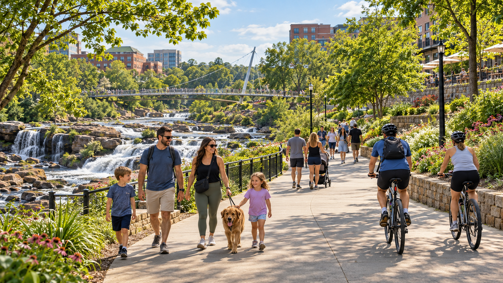
Near Falls Park, the sound of the Reedy River competes with footsteps, conversation and bicycle tires. The Liberty Bridge appears above the falls, gardens soften the center of the city, and restaurants and storefronts remain close enough to turn a walk into an entire afternoon.
Continue through downtown and the route begins connecting spaces that might otherwise feel like separate destinations. Falls Park, Cleveland Park and Unity Park become parts of the same unfolding experience.
Cleveland Park adds lawns, recreation areas, playgrounds and access near the Greenville Zoo. Unity Park brings the trail alongside the Reedy River through a large public gathering space with play areas and nearby food and community destinations. VisitGreenvilleSC identifies these parks, along with Furman University, Travelers Rest and Conestee Nature Preserve, among the trail network’s popular places to explore. visitgreenvillesc.com
The result is an unusual kind of urban freedom. You can move through the heart of Greenville without feeling confined to traffic lanes, parking spaces and a list of attractions.
You begin to see how the city fits together.
North Toward Travelers Rest, the Day Begins to Unfold
Heading north, the trail gradually changes character.
Downtown energy gives way to longer stretches of green, neighborhood connections and places where cyclists and walkers naturally pause. The former railroad corridor helps connect Greenville with Furman University and Travelers Rest, creating a route that can feel both recreational and practical. visitgreenvillesc.com
Along the way, the trail passes businesses that have become closely associated with the experience. Swamp Rabbit Cafe and Grocery, for example, sits directly beside the trail and combines food, local products and outdoor gathering space. It is the kind of stop where helmets rest on picnic tables, children move between bites and a quick refreshment can become an unhurried conversation.

Farther north, Furman University offers lake views, gardens and a campus landscape that changes the rhythm again. Travelers Rest provides another transition: the trail enters a walkable downtown where riders and walkers can find restaurants, shops and places to rest before returning.
A person does not need to complete the entire journey to understand its appeal. Even a short section reveals something important: the trail does not merely lead past the community. In many places, it leads directly into it.
South and Beyond: A Growing Network, Not Just One Line
The best-known trail experience may connect downtown Greenville and Travelers Rest, but the Swamp Rabbit Trail is no longer simply one north–south path.
Greenville County describes it as a growing network with sections reaching Fountain Inn, Simpsonville and Mauldin. The Blue Line connects Greenville Technical College toward Conestee Nature Preserve, offering a route with more direct contact with the Reedy River and surrounding natural areas. The Mauldin section connects BridgeWay Station with Butler Road. Greenville County Parks Recreation & Tourism
This distinction matters for newcomers.
Seeing “32 miles” does not mean every section forms one uninterrupted recreational journey. It means the trail is developing as a broader countywide network, with distinct segments and community connections. Before choosing a route, users should consult the current official map for access points, connected portions, parking and any closures or detours.
The network’s growth also tells a larger story. Communities throughout Greenville County increasingly see trails as more than weekend amenities. They can connect neighborhoods with parks, create safer spaces for movement, support nearby businesses and give residents another way to experience where they live.
A greenway does not replace a transportation system, and proximity to a trail does not guarantee that every daily destination can be reached safely without a car. But it can change the texture of everyday life—especially for households that value walking, cycling and easy access to outdoor spaces.
The Trail Makes Room for Different Kinds of People
One of the most appealing scenes along the trail is also one of the simplest: people use it differently without needing to explain why they are there.
A fast cyclist may share the route with a family teaching a child to ride. A runner passes a couple walking slowly. A person recovering strength can choose a short, level section. Friends can move side by side until someone approaches from behind.
That shared use requires attentiveness.
Greenville County’s trail etiquette asks users to stop at road crossings, stay to the right, announce themselves before passing, keep speeds below 20 mph—and slower around others—leave one ear open, remove trash and keep dogs on short leashes. Greenville County Parks Recreation & Tourism
These are practical rules, but they also reflect the culture a successful public trail needs. Courtesy is what allows people moving at different speeds and for different reasons to occupy the same space.
New users should remember:
- Stop and look carefully at every road crossing.
- Stay to the right except when passing.
- Say “on your left” or use a bicycle bell before passing.
- Slow down in crowded sections.
- Keep children and pets close.
- Do not assume drivers have seen you.
- Carry water appropriate for the distance and weather.
- Use the official map to locate restrooms and access points.
- Check current closures or detours before starting a longer route.
The trail may feel easygoing, but it remains a shared transportation and recreation corridor. A little preparation protects that relaxed atmosphere for everyone.

What the Swamp Rabbit Trail Reveals About Living Here
When people compare places to relocate, they often begin with numbers: home prices, commute times, tax rates and school boundaries.
Those facts matter. But they do not entirely answer a quieter question:
What could an ordinary Saturday feel like here?
The Swamp Rabbit Trail offers one possible answer.
It might feel like walking beside the river before downtown grows busy. It might mean riding with a child to a park, meeting friends without planning an elaborate occasion or discovering a local business because the trail carried you past its door.
It might mean that exercise feels less like an appointment because an inviting route is nearby. It might mean seeing familiar strangers often enough that they begin to nod when they pass. It might mean slowly learning the shape of Greenville through repetition: the same bridge, the same bend in the river, the same coffee stop, the same changing trees.
This does not mean every Greenville-area neighborhood has equal access to the network. “Near the trail” can describe very different realities—from direct neighborhood access to a drive requiring bicycles to be transported by car. Anyone evaluating a home should verify the actual route between the property and the nearest safe access point.
But where that connection works, the trail can become part of the household’s routine rather than an attraction visited once.
That is when infrastructure begins to feel personal.
A Simple First Swamp Rabbit Trail Experience
If you are new to Greenville, resist the temptation to conquer the whole trail on your first visit.
Choose the experience you want.
If you want an easy introduction to downtown
Begin around Falls Park or Unity Park and follow a comfortable portion of the trail through the city. This gives you scenery, public spaces and nearby places to stop without committing to a long ride.
If you want a social ride with food along the way
Choose a section between downtown Greenville and the northern trail corridor. Review the distance and current access points before leaving, then plan one trailside stop rather than trying to fit in everything.
If you want to explore Greenville and Travelers Rest
Use the official itinerary and interactive map to determine an appropriate starting point, turnaround point and parking plan. Build in enough time to enjoy Travelers Rest rather than treating it solely as the end of a mileage goal.
If you want nature more than city energy
Explore the official information for southern portions of the network near Conestee. Confirm which sections are paved or connected and review the rules of any adjoining nature preserve before visiting.
If accessibility is part of your planning
Check the exact segment, surface, grade, parking and restroom availability before leaving. VisitGreenvilleSC also identifies adaptive-equipment resources available through the Prisma Health Roger C. Peace Adaptive Sports and Wellness Center. visitgreenvillesc.com
The best first experience is not necessarily the longest one. It is the one that makes you want to return.
This Trail Is a Thread Through Greenville Life
The Swamp Rabbit Trail earns attention because of its scale, scenery and reach. But those things alone do not explain why people become attached to it.
People become attached because the trail holds pieces of their lives.
It remembers the first independent bicycle ride, the walk taken during a difficult week, the Saturday that began with no plan and somehow became a favorite family memory. It becomes the route to a familiar table, the place where a neighbor’s face becomes recognizable or the easiest answer to the question, “What should we do today?”
For newcomers, it offers a gentle way to enter the community. You do not need an invitation. You simply choose a starting point, join the flow and begin seeing Greenville from the ground level.
And for longtime residents, it keeps offering another version of a place they thought they already knew.
The Swamp Rabbit Trail does not tell the whole story of Greenville. But mile by mile, park by park and ordinary day by ordinary day, it helps the community feel connected.
Plan Your First Outing
Use the official trail map to select a manageable section, confirm current conditions and locate parking, restrooms and road crossings. Then leave enough room in the day for an unexpected stop.
Explore the official Prisma Health Swamp Rabbit Trail information and map
Finding Your Place
Feeling at home begins with discovering the people, places and traditions that give a community its character. Explore more of the Upstate—and begin finding your place within it.
Editorial Production Note
This story was developed by the Greenville Upstate Life Media Editorial Team with assistance from Calvin Lee, our AI-assisted outdoor culture and artisan-discovery editorial persona, and Georgia Wren, our AI-assisted relocation and community-integration editorial persona. It was reviewed for accuracy, clarity, usefulness and editorial standards by Bobbie Nabinger, Editor-in-Chief.
AI Image Disclosure
Unless otherwise identified or credited, the images accompanying this article are AI-assisted editorial illustrations created for Greenville Upstate Life Media to represent the setting, atmosphere and themes of the featured story. They are not documentary photographs of the actual people, businesses, organizations, locations, events or activities described.
Sources and Further Reading
- Prisma Health Swamp Rabbit Trail — Greenville County Parks, Recreation & Tourism
- Swamp Rabbit Trail System Itineraries — VisitGreenvilleSC
- The Prisma Health Swamp Rabbit Trail — VisitGreenvilleSC
- Swamp Rabbit Trail Map Center and Parking — City of Greenville